


DEPTHCHECK
DepthCheck is a simple application that can check a file of
data against a geotiff digital elevation model and display differences. Data
can be read from SPS, RIT or SIT files.
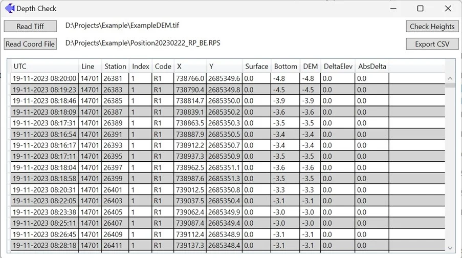
The image above shows the DepthCheck application with a geotiff
DEM file loaded. An SPS file with bottom nodes exported from Position has also
been loaded. The bottom elevations are computed from the surface elevation and
water depth and compared to the value in the corresponding pixel in the tiff
file. The differences are shown in the DeltaElev column, and the absolute
values of these are displayed in the AbsDelta column where they can be sorted
by size. They can then be exported to a CSV file.
Applying a wrong depth model or forgetting to update data
with a revised model is a common error in shallow water surveys. Running
DepthCheck over the final data ensures the corrections have been applied
correctly.